Access without exposure.
Licensed waypoint packs remain tied to authenticated users and registered devices, including encrypted offline delivery.
Product strategy · UX/UI · Mobile + wearable engineering
ReelPoints turns valuable fishing knowledge into secure, glanceable navigation across phone, boat, vehicle, and wrist.
The challenge
Serious anglers collect years of local knowledge, but traditional waypoint files are difficult to organize, easy to copy, and disconnected from the conditions that make a location productive.
ReelPoints had to protect that intelligence while still making it useful in the moments that matter: planning at home, navigating underway, and checking direction without taking a hand off the helm.
Protect the knowledge.
Simplify the route.
Keep eyes on the water.
Experience principles
Licensed waypoint packs remain tied to authenticated users and registered devices, including encrypted offline delivery.
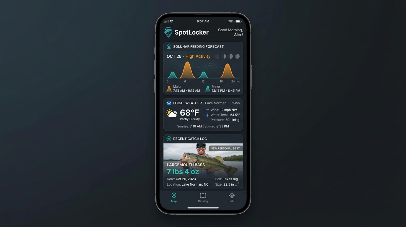
Depth, structure, weather, water, solunar windows, routes, and activity turn a pin into practical fishing intelligence.
Phone, in-vehicle display, helm data, and Wear OS each present only what that moment requires.
One visual language connects discovery, conditions, route planning, anchor monitoring, and live navigation. Screens shown use demonstration data.
The platform
ReelPoints connects the planning tools anglers use before launch with the navigation signals they need underway.
Curated fishing intelligence is licensed, device-bound, and available offline without becoming an unrestricted coordinate download.
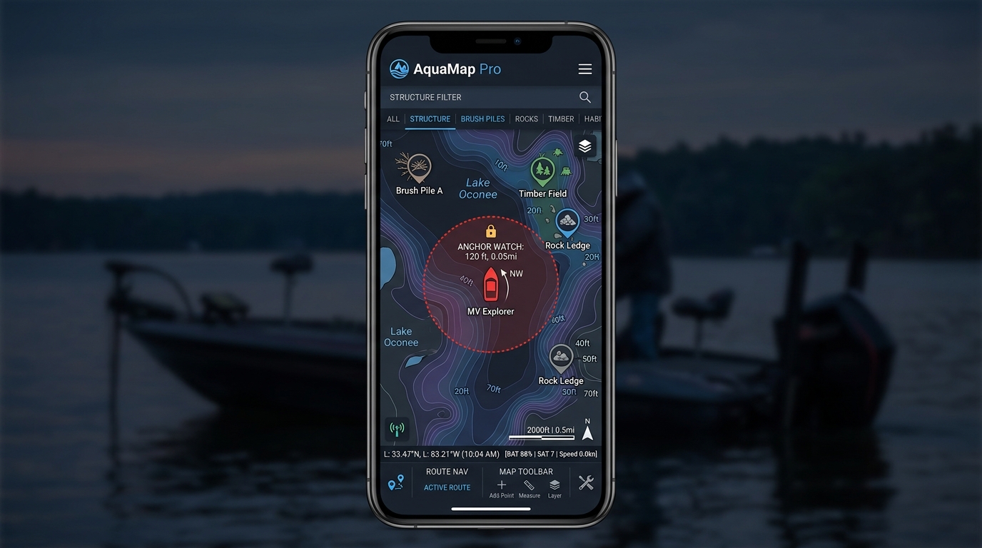
CORE PRODUCTMapLibre mapping, contours, structure filters, routes, and Kalman-smoothed GPS.
Geofenced position monitoring keeps drift visible while the boat is stationary.
Conditions, solunar forecasts, water levels, catch history, and personal records.
NMEA 0183 over Wi-Fi can surface depth, temperature, speed, heading, and vessel position.
Authenticated navigation state extends to compatible in-vehicle displays for the route to launch.
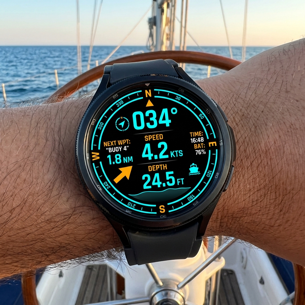
Compass, bearing, speed, depth, battery state, and steer-to guidance stay visible at a glance.
HANDS-FREE CONTEXTWearable navigation
The watch companion reduces the interface to the signals that can be read in a glance. Direction to the active waypoint stays central while speed, depth, connection, and battery state provide the context around it.
Trust boundary
Every request for precise waypoint data passes through the same entitlement chain before coordinates reach an approved device.
Product foundation
The product ecosystem combines cross-platform mobile delivery with native wearable and vehicle experiences, a geospatial platform, and licensed commerce.
Android and iOS navigation, offline intelligence, route planning, catch logging, and anchor watch.
Wearable navigation, marine telemetry, and authenticated Android Auto surfaces.
Authentication, geospatial storage, licensing, device controls, and audit trails.
Waypoint marketplace, customer portal, checkout fulfillment, route tools, and administration.
The outcome
ReelPoints is prepared for listing with a coherent experience spanning secure waypoint commerce, mobile navigation, marine data, Android Auto, and a purpose-built Wear OS companion. Adoption and field-performance metrics will be added after release.